DEDHAM, Mass. — The first of three winter storms on the Boston 25 Weather team’s radar is expected to bring snow, ice, and rain to Massachusetts on Thursday, likely disrupting travel on roads across the region.
Boston 25 Meteorologist Shiri Spear has us on a WEATHER ALERT and the National Weather Service issued a winter weather advisory for nearly all of Massachusetts.
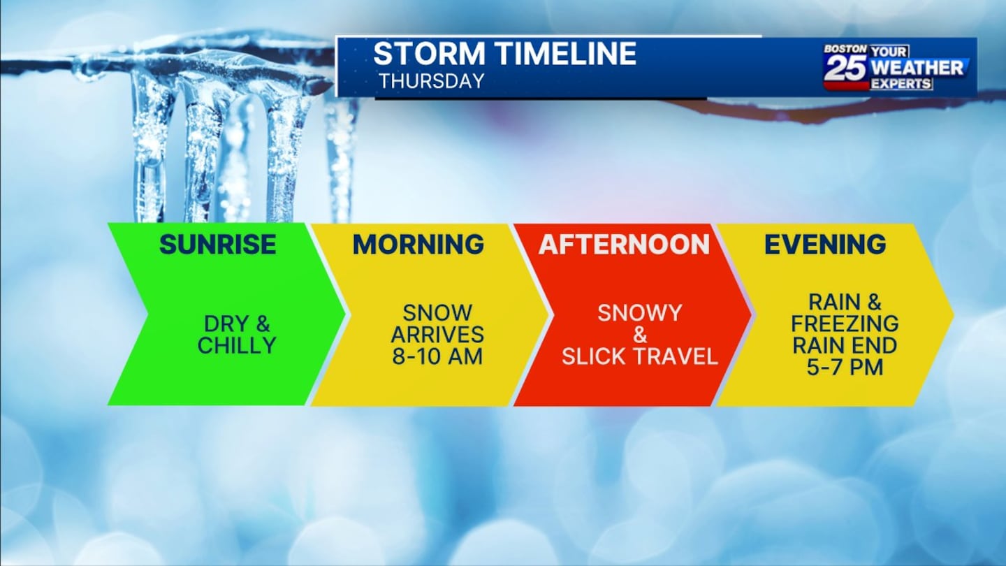
Sunrise on Thursday will be dry and chilly, but snow is projected to arrive between 8 and 10 a.m., persisting into the afternoon before ice mixes in. A flip to mixed precipitation, including pockets of rain and freezing drizzle, ending between 5 p.m. and 7 p.m.
“Roads will quickly become snow-covered with chilly temperatures in place. Accumulation will peak at lunchtime and afternoon with snowy, icy, and slushy roads in most local towns,” Spear wrote in her latest weather blog. “Slightly milder temperatures in southeastern Massachusetts will allow for a gradual change to rain. I’m skeptical about that mild air making it north and west of Boston.”
Spear said in her latest forecast, “I want you to time your travel pretty carefully tomorrow. A lot of the main piece of the day is going to be pretty gnarly.”
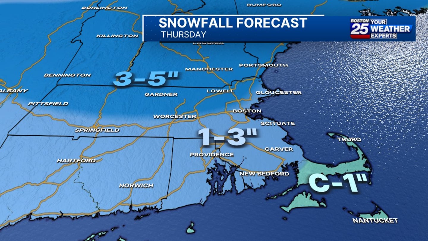
Three to 5 inches of snow is expected across communities north of the Massachusetts Turnpike, including parts of the North Shore, Merrimack Valley, the Worcester area, and western Massachusetts.
One to 3 inches of snow is expected in the Boston area and south of the Pike, along the South Shore and South Coast.
Cape Cod and the Islands will likely only see a coating to 1 inch of snow and sleet accumulation.
Catch your breath on Friday and Saturday, Spear advised, because another batch of snow is set to move in late Saturday evening.
Most precipitation looks to come through overnight and Sunday morning, but light rain and snow showers could linger during the day.
“During the day on Sunday, I think things lighten up considerably. I wouldn’t call it a washout,” Spear said.
Monday is expected to be a quiet weather day but Spear said a third storm system “is lined up for sometime into Tuesday night or Wednesday.”
It remains too early to project snowfall totals for Saturday night into Sunday and next week’s storm.
To stay up to date with the latest forecast, visit the Boston 25 Weather page.
Download the FREE Boston 25 News app for breaking news alerts.
Follow Boston 25 News on Facebook and Twitter. | Watch Boston 25 News NOW
©2025 Cox Media Group
/cloudfront-us-east-1.images.arcpublishing.com/cmg/7QOJU3BNCJERBNKJC5LWTBYFLU.png)


